Although Vermont would not officially join the union until 1791, its legislature prohibited slavery in 1777. Pennsylvania, Massachusetts, New Hampshire, Connecticut, Rhode Island, New York, and New Jersey soon followed. In 1780 the Pennsylvania legislature enacted an Act for the Gradual Abolition of Slavery. The legislators wrote that they rejoiced “to extend a portion of that freedom to others which has been extended to us.” Rights provided by the act for freed blacks included recognition of marriage contracts, protection of orphaned or abandoned children, and equality before the law. Blacks had the right to vote but rarely exercised it. In 1838 voting rights in Pennsylvania were rescinded.
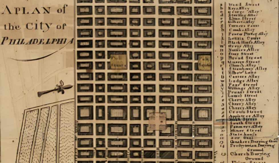
John Norman’s “A Plan of the City of Philadelphia” is a historical map created around 1777, during a pivotal period in American history. John Norman was a prominent surveyor and cartographer of the time, and his map provides a detailed view of Philadelphia during the American Revolutionary War.
The map is notable for several reasons:
- Historical Context: Philadelphia was a major center of activity during the American Revolution, serving as the capital of the United States from 1790 to 1800. The map offers insights into the city’s layout and infrastructure just before the British occupation of the city in 1777.
- Detail and Accuracy: Norman’s map is known for its accuracy and detail, showing streets, buildings, and other features of Philadelphia. It provides valuable information about the city’s layout during this period, including key landmarks and the street grid.
- Cartographic Techniques: The map reflects the cartographic techniques and conventions of the late 18th century, including hand-drawn elements and engravings. It serves as a historical document that reveals how Philadelphia was perceived and represented at the time.
- Preservation of History: The map is a crucial historical artifact that helps historians and researchers understand the urban development of Philadelphia in the late 18th century. It also offers a snapshot of the city at a time of significant political and social change.
Overall, John Norman’s map is a valuable resource for those interested in early American history and the development of Philadelphia as a major American city.